UrbanShift Lab Empowers Puducherry to Tackle Climate Risks with Geospatial Planning
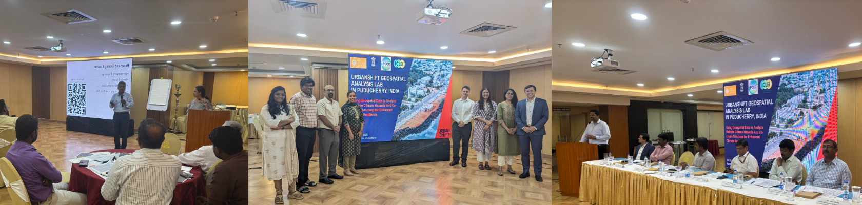
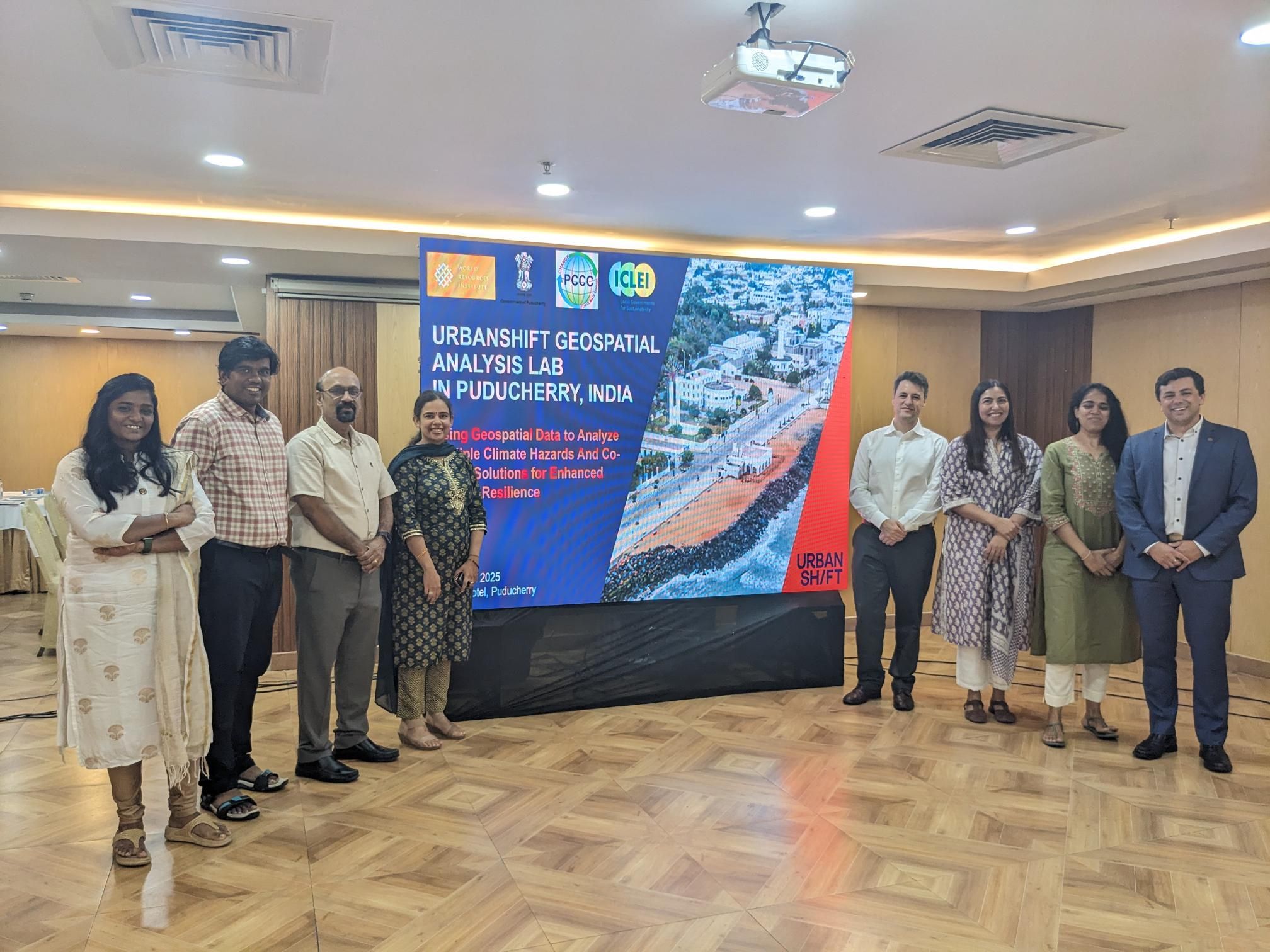
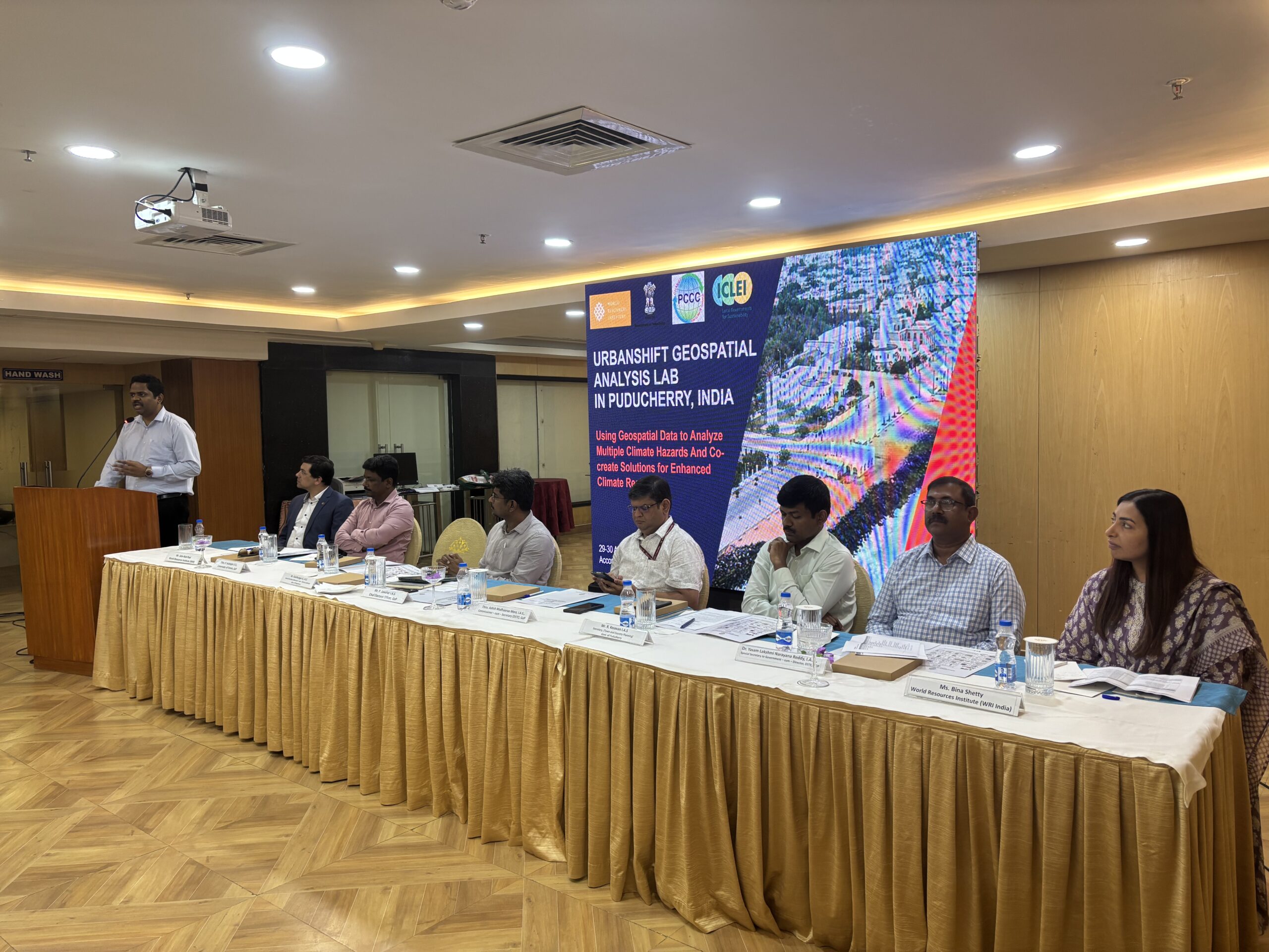
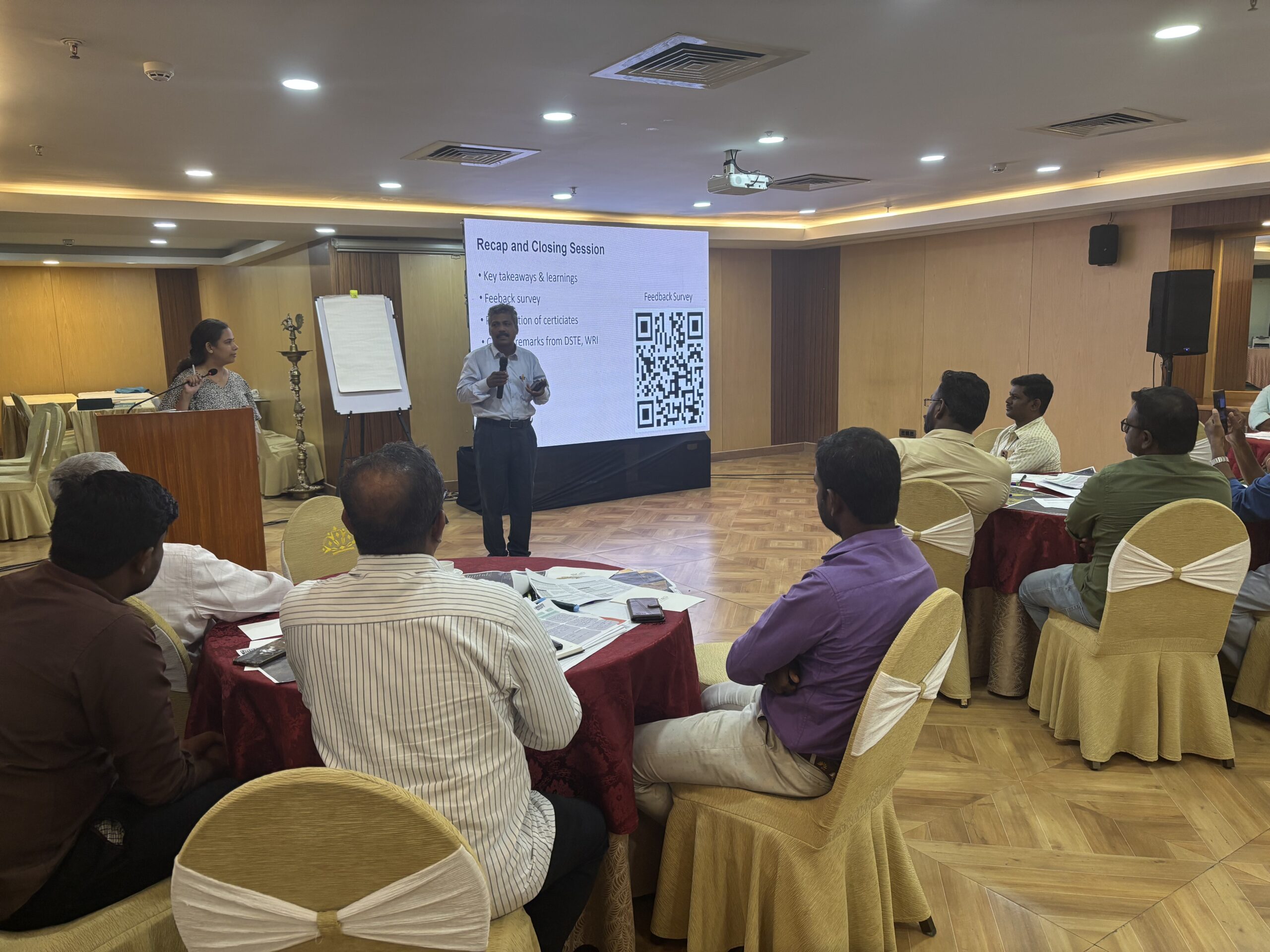
ICLEI- Local Governments for Sustainability, in partnership with the Puducherry Climate Change Cell in the Department for Science, Technology and the Environment (DSTE), Town and Country Planning Department, Department of Revenue and Disaster Management, Government of Puducherry, and World Resources Institute (WRI) hosted an in-person workshop titled “UrbanShift Geospatial Analysis Lab” in Puducherry on 29 and 30 April 2025.
The workshop focused on using geospatial data to analyse multi-hazard risks and create solutions for a climate-resilient Puducherry. Part of the global UrbanShift Programme led by the United Nations Environment Programme, and supported by organisations such as C40 Cities, WRI, ICLEI, United Nations Development Programme, World Bank Group, and Asian Development Bank, the UrbanShift Lab is designed to promote integrated, data-driven urban planning through hands-on, multi-stakeholder engagement at the local level.
Understanding climate risks
As a low-lying coastal city, Puducherry is highly vulnerable to climate-related hazards like flooding, urban heat, cyclones, and coastal surges. These risks are compounded by dense urban development, limited green cover, and the city’s proximity to the Bay of Bengal. It frequently experiences waterlogging, property damage, and displacement of communities. Intensifying urban heat, exacerbated by dense development and limited green spaces, poses health risks, particularly for the elderly and low-income populations. These recurring hazards disrupt livelihoods, hinder tourism and commerce, and strain local economic development and recovery efforts.
The UrbanShift Geospatial Planning Analysis Lab workshop provided an opportunity for city stakeholders and external experts to collaborate on finding solutions to these challenges and strengthen Puducherry’s climate resilience planning.
Highlights from the Workshop
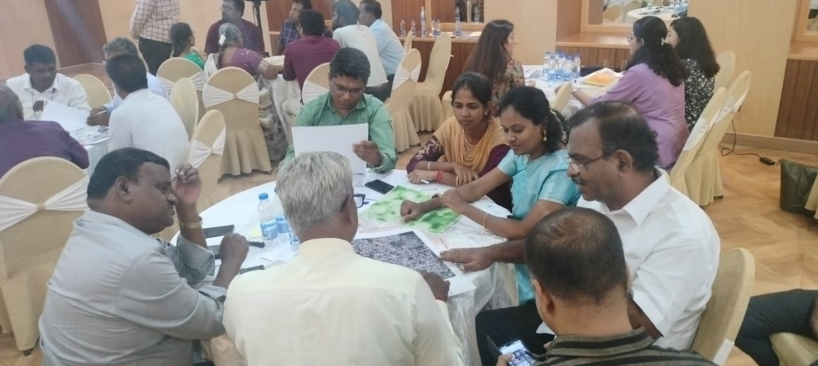
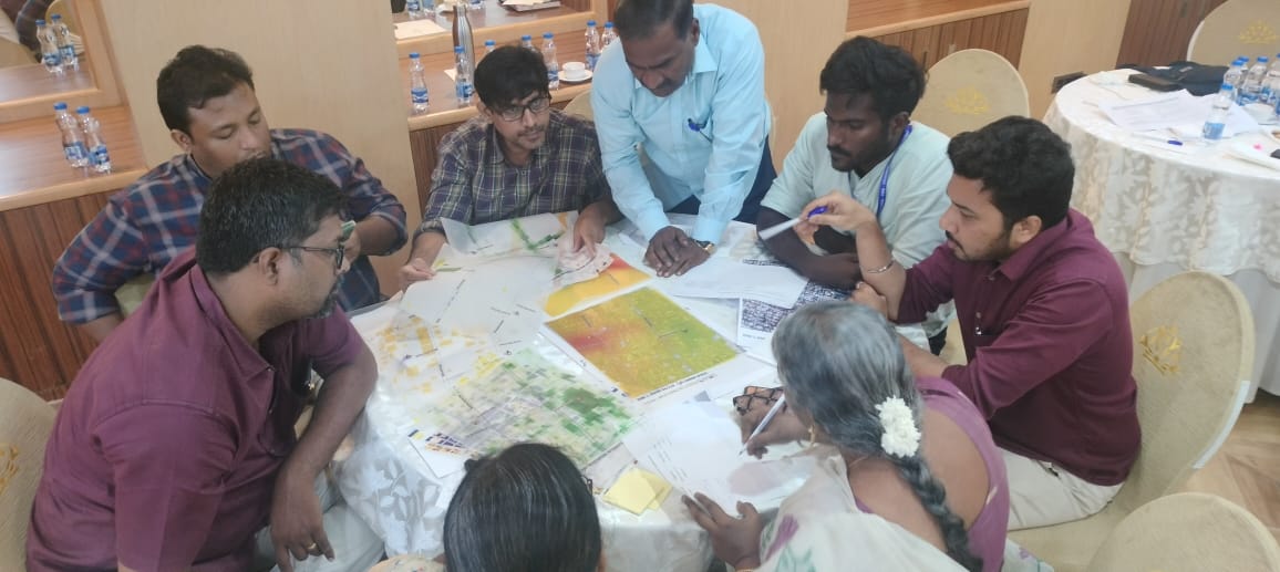
The Lab’s participants discussed how geospatial data could be used to analyse the risks associated with extreme heat, flooding, coastal stormwater surges, wind and cyclones facing the city, and co-create potential solutions. The scope of the workshop’s activities was co-designed with the city to address the main flooding risks and other challenges that Puducherry faces.
Dr. Debolina Kundu, Director, National Institute of Urban Affairs, addressed the workshop virtually, and stressed the urgent need for integrated planning, noting Puducherry’s high vulnerability to floods, cyclones and storm surges, with marginalised communities facing disproportionate risks. The participants from Puducherry included Ashish Madhaorao More, IAS, Commissioner-cum- Secretary, DSTE; P Jawahar, IAS, Chief Electoral Officer, Government of Puducherry; R Kesavan, IAS, Secretary, Town and Country Planning Department; Kulothungan A, IAS, Special Secretary, Revenue-cum-District Collectorate, Department of Revenue and Disaster Management; Arul Rajan, IFS, Conservator of Forests, Government of Puducherry; and Dr Yasam Lakshmi Narayana Reddy, IAS, Special Secretary-cum-Director (Science, Technology and Environment).
In addition, representatives from two municipalities of Puducherry, the Electricity Department, Public Works Department, Revenue and Disaster Management Department, Puducherry Technological University, the National Institute of Technology Puducherry, and Surat Municipal Corporation also contributed to the discussions.
Avantika Arjuna, UrbanShift Country Coordinator for India, ICLEI South Asia, highlighted how the Lab was a platform for all relevant stakeholders to come together and co-create implementable solutions to tackle extreme climate situations. She thanked Puducherry’s local administrative leadership for their proactive approach in adopting this model of discussion.
Key discussions covered Puducherry’s efforts to finalise its Coastal Resilience Management Plan and initiatives like ‘Count the Carbon’ to address carbon emissions and assess the election-related carbon footprint. The workshop revealed how the intensity and frequency of coastal risks in India were increasing, thereby making community and ward-level planning critical. It also highlighted the need to invest time and resources in collecting quality data to support effective planning and informed decision-making. The participants emphasised the tremendous support and knowledge exchange between stakeholders and departments, essential for designing solutions, and that while India did not lack policies, finding ways to implement them was equally significant. Cross-institutional collaboration and knowledge sharing have played a substantial role in improving Puducherry’s resilience to disasters such as floods, heat, and storm surges.
Conclusion
The UrbanShift Lab facilitated the review of up-to-date geospatial data and risk analyses, helping officials and planners understand the spatial distribution and intensity of climate vulnerabilities in Puducherry. The workshop aimed to ensure that such a data-driven, participatory approach empowered local authorities to co-create targeted solutions—such as flood-resilient infrastructure, green cooling corridors, and improved stormwater management systems—ensuring that future policies and urban planning efforts are adaptive and inclusive.
This collaborative framework will not only support Puducherry in immediate risk reduction but also help the city build a safer, more climate-resilient future.