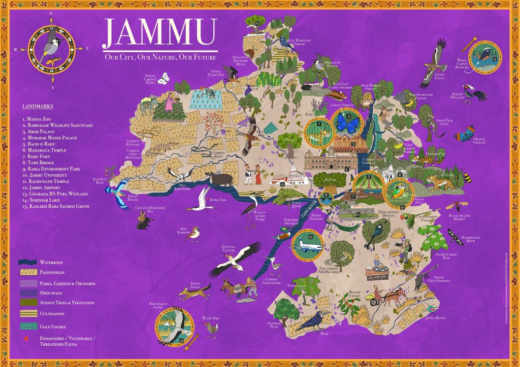
Hon’ble Lt. Governor Mr. Manoj Sinha released the Illustrated Natural Asset Maps of Jammu and Srinagar on the occasion of World Environment Day on the 5th of June 2022. The maps have been developed to communicate the significance and need to conserve urban biodiversity with the citizens.
Illustrated Natural Asset Maps are distinctive visual tools that simplify, represent and communicate information about complex ecosystem structures, functions and services in a geographical area. The maps of Jammu and Srinagar have been developed by ICLEI South Asia as a part of the INTERACT-Bio project, which is supported by the German Federal Ministry for the Environment, Nature Conservation, Nuclear Safety and Consumer Protection. Jammu and Srinagar were added as satellite cities to the project, and the maps have been developed at the request of the Jammu and Kashmir Biodiversity Council. They have been mapped on the GIS platform after extensive field research. Similar maps have already been developed for the cities of Kochi, Panaji and Gangtok under the INTERACT-Bio project. Download the full map here.